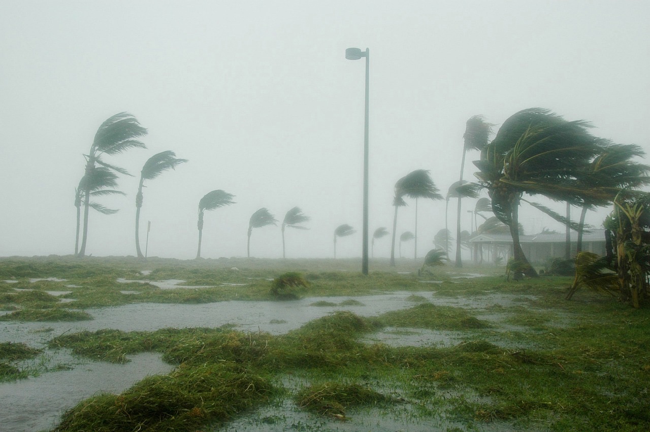
Florida is known for its beautiful beaches, warm weather, and unfortunately, its frequent encounters with hurricanes. Year after year, the state finds itself in the path of many hurricanes, making it one of the most hurricane-prone regions in the United States. The question is, why does Florida experience so many hurricanes? The answer lies in a combination of geography, climate, ocean conditions, and the state’s proximity to some of the most active hurricane-producing areas in the Atlantic basin.
In this article, we will explore the main reasons why Florida experiences such frequent hurricanes, looking at factors such as location, weather patterns, and oceanic conditions that contribute to the state’s vulnerability to these powerful storms.
1. Florida’s Geographic Location
One of the primary reasons Florida experiences so many hurricanes is its geographic location. Florida is a long, narrow peninsula situated between the Atlantic Ocean and the Gulf of Mexico, both of which are hurricane-prone regions. The state’s position between these two large bodies of water makes it an easy target for hurricanes that form in the Atlantic Ocean, Caribbean Sea, and Gulf of Mexico.
The Atlantic Ocean is one of the most active regions for hurricane formation, particularly during the Atlantic hurricane season, which runs from June 1 to November 30. Hurricanes that form off the coast of West Africa, also known as Cape Verde hurricanes, often track westward toward the Caribbean and the southeastern United States, including Florida. Additionally, hurricanes that develop in the Caribbean or the Gulf of Mexico often make landfall in Florida due to the state’s proximity to these areas.
Florida’s peninsular shape means that it has extensive coastline on both the east and west, increasing the chances that hurricanes will strike from either direction. As a result, Florida can be hit by hurricanes that approach from the Atlantic as well as storms that originate in the Gulf of Mexico.
2. Warm Ocean Waters Surround Florida
Hurricanes need warm water to form and strengthen, and the waters around Florida provide the perfect environment for hurricane development. Hurricanes typically form when sea surface temperatures reach at least 80°F (27°C). The Atlantic Ocean, the Caribbean Sea, and the Gulf of Mexico all have warm waters during the hurricane season, making these areas ideal for tropical cyclones to develop and intensify.
The Gulf of Mexico, in particular, is known for its warm, shallow waters, which can lead to the rapid intensification of hurricanes as they approach Florida’s western coast. Additionally, the Florida Straits, the narrow body of water between the southern tip of Florida and the northern coast of Cuba, is a hotspot for hurricane activity due to its consistently warm temperatures.
The presence of warm waters on both sides of Florida means that hurricanes can develop, strengthen, and strike the state from either the Atlantic or the Gulf of Mexico.
3. The Atlantic Hurricane Season
The Atlantic hurricane season, which runs from June 1 to November 30, is the time of year when conditions are most favorable for hurricanes to form. Florida’s location within the Atlantic basin means that it is frequently in the path of hurricanes during this time.
During the peak months of the hurricane season—August, September, and October—sea surface temperatures are at their warmest, and atmospheric conditions are ideal for hurricane formation. Tropical waves that move off the coast of West Africa during these months often develop into tropical storms or hurricanes as they move westward across the Atlantic, heading toward the Caribbean and the southeastern United States.
Florida’s position at the edge of the Atlantic hurricane basin puts it directly in the path of many of these storms. Additionally, hurricanes that develop in the Caribbean Sea or the Gulf of Mexico often track northward toward Florida, making it one of the first states to be affected by these storms.
4. Tropical Waves and Disturbances
Many of the hurricanes that strike Florida begin as tropical waves or disturbances that form off the coast of Africa. These disturbances are carried westward across the Atlantic by the trade winds, and as they encounter the warm waters of the Atlantic and Caribbean, they can develop into tropical storms and hurricanes.
Florida is particularly vulnerable to hurricanes that originate from Cape Verde, a group of islands off the coast of West Africa. These storms, known as Cape Verde hurricanes, tend to be large and powerful, and they often track westward across the Atlantic, eventually making landfall in the Caribbean or the southeastern United States.
In addition to Cape Verde hurricanes, tropical disturbances can also form in the Caribbean Sea or the Gulf of Mexico and move northward toward Florida. The state’s location at the northern edge of the Caribbean means that it is often one of the first places to be hit by these tropical systems.
5. Wind Patterns and the Coriolis Effect
Another factor that contributes to Florida’s frequent hurricanes is the state’s location within the tropical belt, where specific wind patterns and the Coriolis effect influence the movement of tropical storms and hurricanes. The trade winds in the tropics generally blow from east to west, pushing hurricanes that form in the Atlantic toward the Caribbean and the southeastern United States.
Once a tropical storm or hurricane forms, the Coriolis effect—caused by the Earth’s rotation—helps spin the storm and influences its path. The Coriolis effect causes storms to curve to the right in the Northern Hemisphere, which often directs hurricanes toward the United States, including Florida.
In addition, high-pressure systems over the Atlantic, known as the Bermuda High, can steer hurricanes toward Florida by blocking the storm’s path and forcing it to move westward.
6. Low Wind Shear During Hurricane Season
Wind shear refers to the change in wind speed or direction with altitude. High wind shear can prevent hurricanes from forming or weaken existing storms by disrupting their structure. However, during the Atlantic hurricane season, wind shear is typically low in the regions surrounding Florida, allowing tropical storms and hurricanes to develop and strengthen.
In the Gulf of Mexico and Atlantic Ocean, conditions during hurricane season often feature low wind shear, warm ocean temperatures, and high humidity, all of which are conducive to the development of strong hurricanes. As a result, hurricanes that form near Florida can grow rapidly in intensity and cause significant damage when they make landfall.
7. Climate Change and Rising Ocean Temperatures
Climate change is playing an increasingly significant role in the frequency and intensity of hurricanes. As global temperatures rise, ocean temperatures are also increasing, providing more energy for hurricanes to develop and strengthen. Warmer waters contribute to more frequent and more intense storms, which can lead to greater damage when hurricanes make landfall.
Rising sea levels due to climate change also exacerbate the effects of hurricanes in Florida by increasing the risk of storm surges and flooding. Storm surges, which are caused by the strong winds of a hurricane pushing seawater onto the coast, are already a major concern for low-lying areas of Florida. As sea levels continue to rise, the impact of storm surges during hurricanes is likely to become even more severe.
8. Florida’s Extensive Coastline
Florida has one of the longest coastlines in the United States, with 1,350 miles of coastline along the Atlantic Ocean and the Gulf of Mexico. This extensive coastline increases the likelihood that a hurricane will make landfall in the state, as there are many potential points of impact.
Florida’s low-lying terrain and proximity to the ocean also make it particularly vulnerable to storm surges, which can cause widespread flooding and damage during hurricanes. Coastal cities like Miami, Tampa, and Jacksonville are especially at risk for storm surge damage due to their locations near sea level.
9. The Bermuda High
The Bermuda High is a high-pressure system that often forms over the Atlantic Ocean during hurricane season. This system can influence the movement of hurricanes by steering them westward toward the Caribbean and the southeastern United States, including Florida.
When the Bermuda High is positioned in a way that blocks a hurricane’s path to the north, it forces the storm to move westward, increasing the likelihood that it will strike Florida. This weather pattern is one of the reasons why Florida frequently finds itself in the direct path of hurricanes during the Atlantic hurricane season.
Conclusion
Florida’s frequent hurricanes are the result of several factors, including its geographic location, proximity to warm ocean waters, and weather patterns that steer storms toward the state. The state’s position between the Atlantic Ocean and the Gulf of Mexico, along with its low-lying coastline, makes it particularly vulnerable to hurricanes during the Atlantic hurricane season.
Additionally, climate change is contributing to warmer ocean temperatures and rising sea levels, which are expected to increase the frequency and intensity of hurricanes in the future. Understanding the reasons behind Florida’s susceptibility to hurricanes can help residents better prepare for these powerful storms and reduce the damage they cause.
For Florida residents, staying informed and taking proactive steps to prepare for hurricanes is essential, given the state’s ongoing exposure to these natural disasters.


